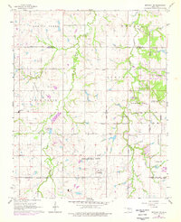
1966 Map of Bethany NE
USGS Topo · Published 1976About this map
West Edmond Oil and Gas Field dominates the landscape of this mid-1960s survey, showing a transition between the suburban expansion of Edmond and the industrial infrastructure of the central Oklahoma plains. Numerous Oil Well and Oil Wells are scattered across the terrain, supported by a Gas Processing Plant and multiple pipelines that weave through the drainage basins of Spring Creek and Chisholm Creek.
Find a feature on this map
39 named features on this map. Tap any name to fly to it.
Don’t see what you’re looking for? This feature index may not catch every label — zoom into the map to look around manually.
Map Details
Editions of this 1966 Bethany NE Map
Other maps of this area

1892 · Guthrie
USGS Topo · 1:62,500

1892 · Edmond
USGS Topo · 1:62,500

1892 · Kingfisher
USGS Topo · 1:125,000

1895 · Kingfisher
USGS Topo · 1:125,000

1935 · Spencer
USGS Topo · 1:24,000

1935 · Edmond
USGS Topo · 1:48,000

1940 · Edmond
USGS Topo · 1:62,500

1951 · Britton
USGS Topo · 1:24,000

1954 · Oklahoma City
USGS Topo · 1:250,000
1956 · Spencer
USGS Topo · 1:24,000