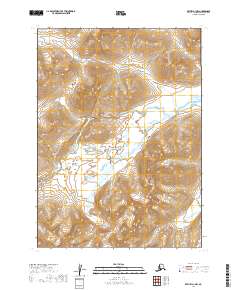
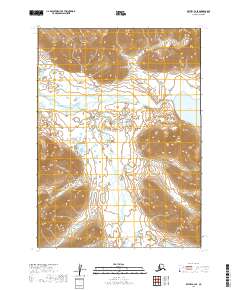
2019 Map of Bethel A-1 NW
USGS Topo · Published 2019About this map
Milk Creek winds through this undeveloped landscape in the Dillingham Census Area, serving as the primary drainage for the surrounding terrain. This 2019 survey, published by the U.S. Geological Survey, illustrates a high-altitude wilderness where steep topographic contours define the basin. The map area is organized by several township and range boundaries, including t1n r58w and t2n r57w, which provide the structural framework for this remote section of Alaska. While no settlements or roads are present, the detailed hydrologic data of the creek and the dense contour intervals offer an exact record of the watershed's physical geography in the early 21st century.
Find a feature on this map
7 named features on this map. Tap any name to fly to it.
Don’t see what you’re looking for? This feature index may not catch every label — zoom into the map to look around manually.
Map Details
Editions of this 2019 Bethel A-1 NW Map
This is the sole edition of this map. No revisions or reprints were ever made.
Other maps of this area

1950 · Bethel
USGS Topo · 1:250,000

1979 · Bethel B-1
USGS Topo · 1:63,360

1979 · Bethel A-1
USGS Topo · 1:63,360

1979 · Bethel A-2
USGS Topo · 1:63,360

1979 · Bethel B-2
USGS Topo · 1:63,360

1980 · Bethel
USGS Topo · 1:250,000
2019 · Bethel A-1 NE
USGS Topo · 1:25,000
2019 · Bethel A-1 SW
USGS Topo · 1:25,000
2019 · Bethel A-1 SE
USGS Topo · 1:25,000
2019 · Bethel B-2 SE
USGS Topo · 1:25,000