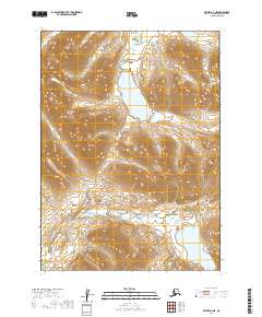
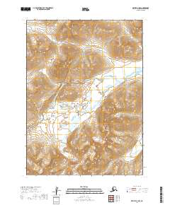
2019 Map of Bethel A-2 NE
USGS Topo · Published 2019About this map
Gold Lake sits at the center of this remote Alaskan interior landscape, surrounded by high-elevation terrain where the headwaters of Gold Cr and Milk Creek begin their descent. This 2019 survey captures the hydrological patterns of the Dillingham Census Area, including the expansive Cascade Lake in the southern reaches. The map is defined by its topographic density, showing a wilderness area marked primarily by its water systems and the lack of human infrastructure or established roads. These drainages are critical markers for anyone studying the geography of southwest Alaska, illustrating the natural flow from alpine lakes into the larger creek networks that feed the region's river basins.
Find a feature on this map
11 named features on this map. Tap any name to fly to it.
Don’t see what you’re looking for? This feature index may not catch every label — zoom into the map to look around manually.
Map Details
Editions of this 2019 Bethel A-2 NE Map
This is the sole edition of this map. No revisions or reprints were ever made.
Other maps of this area

1950 · Bethel
USGS Topo · 1:250,000

1979 · Bethel B-1
USGS Topo · 1:63,360

1979 · Bethel A-1
USGS Topo · 1:63,360

1979 · Bethel A-2
USGS Topo · 1:63,360

1979 · Bethel B-2
USGS Topo · 1:63,360

1980 · Bethel
USGS Topo · 1:250,000
2019 · Bethel A-1 SW
USGS Topo · 1:25,000
2019 · Bethel B-2 SW
USGS Topo · 1:25,000
2019 · Bethel B-2 SE
USGS Topo · 1:25,000
2019 · Bethel A-1 NW
USGS Topo · 1:25,000