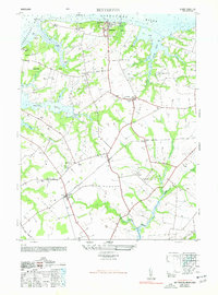
1948 Map of Betterton
USGS Topo · Published 1977About this map
The Sassafras River and Chesapeake Bay define the northern and western bounds of this 1940s landscape, where the maritime and agricultural traditions of Kent County converge. Coastal activity is centered around Betterton and Harris Wharf, while the interior reveals a network of rural settlements like Stillpond, Coleman, and Worton. The Pennsylvania railroad cuts through the terrain, serving essential stops such as Still Pond Station, which anchored the local economy before modern transit shifts.
Find a feature on this map
40 named features on this map. Tap any name to fly to it.
Don’t see what you’re looking for? This feature index may not catch every label — zoom into the map to look around manually.
Map Details
Editions of this 1948 Betterton Map
4 editions found
Other maps of this area

1898 · Tolchester
USGS Topo · 1:125,000

1899 · Dover
USGS Topo · 1:125,000

1900 · Cecilton
USGS Topo · 1:62,500

1900 · Betterton
USGS Topo · 1:62,500

1901 · Chestertown
USGS Topo · 1:62,500

1903 · Tolchester
USGS Topo · 1:125,000

1905 · Barclay
USGS Topo · 1:62,500

1906 · Dover
USGS Topo · 1:125,000

1908 · Tolchester
USGS Topo · 1:125,000

1920 · Dover
USGS Topo · 1:125,000