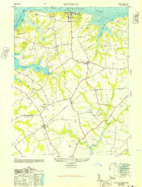
1948 Map of Betterton
USGS Topo · Published 1948About this map
Betterton stands as a prominent bayside settlement on this Kent County landscape, overlooking the confluence of the Sassafras River and the Chesapeake Bay. The 1948 survey highlights a coastal economy transitioning from maritime commerce at Harris Wharf to agricultural and recreational pursuits, evidenced by the Camp Tockwogh YMCA and several named agricultural operations like Fair Promise Stock Farm and Blooming Turkey Farm.
Find a feature on this map
37 named features on this map. Tap any name to fly to it.
Don’t see what you’re looking for? This feature index may not catch every label — zoom into the map to look around manually.
Map Details
Editions of this 1948 Betterton Map
4 editions found
Other maps of this area

1898 · Tolchester
USGS Topo · 1:125,000

1899 · Dover
USGS Topo · 1:125,000

1900 · Cecilton
USGS Topo · 1:62,500

1900 · Betterton
USGS Topo · 1:62,500

1901 · Chestertown
USGS Topo · 1:62,500

1903 · Tolchester
USGS Topo · 1:125,000

1905 · Barclay
USGS Topo · 1:62,500

1906 · Dover
USGS Topo · 1:125,000

1908 · Tolchester
USGS Topo · 1:125,000

1920 · Dover
USGS Topo · 1:125,000