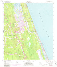
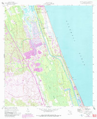
1956 Map of Beverly Beach
USGS Topo · Published 1981About this map
Graham Swamp dominates the inland landscape of this Florida coastal survey, illustrating the complex hydrology where freshwater wetlands meet the tidal influence of the Matanzas River. The map shows a mid-century coastal environment transitioning through residential development along the Intracoastal Waterway, with newer subdivisions emerging near Bon Terra and Beverly Beach. Long-standing transportation corridors like Old Kings Road and St Joe Road provide historical depth, tracing the routes that predated the modern highway system.
Find a feature on this map
21 named features on this map. Tap any name to fly to it.
Don’t see what you’re looking for? This feature index may not catch every label — zoom into the map to look around manually.
Map Details
Editions of this 1956 Beverly Beach Map
5 editions found
Other maps of this area

1927 · Matanzas
USGS Topo · 1:48,000

1937 · Dinner Island
USGS Topo · 1:48,000

1937 · Ormond
USGS Topo · 1:48,000

1943 · Dinner Island
USGS Topo · 1:62,500

1943 · Matanzas
USGS Topo · 1:62,500

1944 · Ormond
USGS Topo · 1:62,500

1944 · Dinner Island
USGS Topo · 1:62,500

1944 · Matanzas
USGS Topo · 1:62,500

1954 · Daytona Beach
USGS Topo · 1:250,000

1956 · Dinner Island NE
USGS Topo · 1:24,000