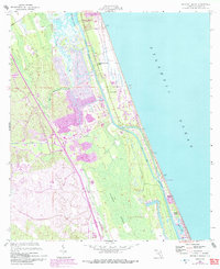
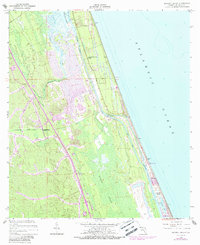
1956 Map of Beverly Beach
USGS Topo · Published 1992About this map
The Matanzas River and the Intracoastal Waterway define the coastal landscape of this Flagler County region, where the Atlantic shoreline meets dense wetlands. In the north, Washington Oaks State Gardens preserves a significant stretch of the barrier island, while further south, settlements like Bon Terra, Painters Hill, and Beverly Beach cluster along the beach. The map illustrates the shift from these coastal communities to the interior wilderness of Graham Swamp, showing how the land was managed through features like the Fox Cut and several drainage canals.
Find a feature on this map
25 named features on this map. Tap any name to fly to it.
Don’t see what you’re looking for? This feature index may not catch every label — zoom into the map to look around manually.
Map Details
Editions of this 1956 Beverly Beach Map
5 editions found
Other maps of this area

1927 · Matanzas
USGS Topo · 1:48,000

1937 · Dinner Island
USGS Topo · 1:48,000

1937 · Ormond
USGS Topo · 1:48,000

1943 · Dinner Island
USGS Topo · 1:62,500

1943 · Matanzas
USGS Topo · 1:62,500

1944 · Ormond
USGS Topo · 1:62,500

1944 · Dinner Island
USGS Topo · 1:62,500

1944 · Matanzas
USGS Topo · 1:62,500

1954 · Daytona Beach
USGS Topo · 1:250,000

1956 · Dinner Island NE
USGS Topo · 1:24,000