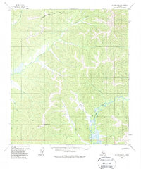
1958 Map of Big Delta B-3
USGS Topo · Published 1988About this map
Shaw Creek Dome stands as a prominent topographical anchor in this subarctic interior, where the Fairbanks North Star Borough boundary meets an intricate network of waterways. The drainage pattern is dominated by Shaw Creek and the Goodpaster River, with numerous tributaries such as Tenmile Creek and Sevenmile Creek carving through the elevation.
Find a feature on this map
12 named features on this map. Tap any name to fly to it.
Don’t see what you’re looking for? This feature index may not catch every label — zoom into the map to look around manually.
Map Details
Editions of this 1958 Big Delta B-3 Map
3 editions found

Other maps of this area

1950 · Big Delta
USGS Topo · 1:250,000

1950 · Big Delta A-4
USGS Topo · 1:63,360

1950 · Big Delta B-4
USGS Topo · 1:63,360

1951 · Big Delta
USGS Topo · 1:250,000

1952 · Big Delta A-4
USGS Topo · 1:63,360

1953 · Big Delta B-4
USGS Topo · 1:63,360

1954 · Big Delta A-2
USGS Topo · 1:63,360

1955 · Big Delta A-3
USGS Topo · 1:63,360

1955 · Big Delta A-2
USGS Topo · 1:63,360

1958 · Big Delta C-4
USGS Topo · 1:63,360