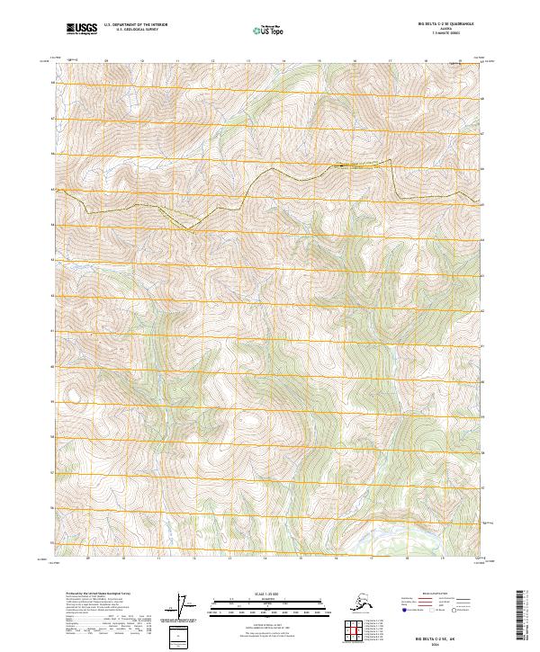
2024 Map of Big Delta C-2 SE
USGS Topo · Published 2024About this map
Glacier Creek defines the interior drainage of this high-altitude landscape, carving through steep terrain in the central and western reaches of the quadrangle. In the southeastern corner, the Goodpaster River emerges, representing a primary hydrological artery for this portion of the interior. The map documents the political and administrative divide of the Fairbanks North Star Borough Southeast Fairbanks Census Area, an boundary that follows the irregular high ridges of the mountain range. This 2024 survey reflects a wilderness character primarily defined by its physical geography, with section lines and township markers providing the only human-imposed grid over the complex series of summits and valleys.
Find a feature on this map
9 named features on this map. Tap any name to fly to it.
Don’t see what you’re looking for? This feature index may not catch every label — zoom into the map to look around manually.
Map Details
Editions of this 2024 Big Delta C-2 SE Map
This is the sole edition of this map. No revisions or reprints were ever made.
Other maps of this area

1950 · Big Delta
USGS Topo · 1:250,000

1951 · Big Delta
USGS Topo · 1:250,000

1958 · Big Delta B-2
USGS Topo · 1:63,360

1958 · Big Delta B-1
USGS Topo · 1:63,360

1958 · Big Delta C-2
USGS Topo · 1:63,360

1958 · Big Delta C-1
USGS Topo · 1:63,360

1958 · Big Delta
USGS Topo · 1:250,000
2018 · Big Delta C-1 NW
USGS Topo · 1:25,000
2018 · Big Delta C-2 NE
USGS Topo · 1:25,000
2018 · Big Delta C-2 SE
USGS Topo · 1:25,000