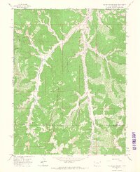
1964 Map of Big Foundation Creek
USGS Topo · Published 1968About this map
The high plateau and canyon country of western Colorado dominate this 1960s survey, defined by the deep drainage of West Fork Douglas Creek and the surrounding ridgelines. The landscape is a study in resource extraction and remote infrastructure, where a prominent pipeline and Douglas Pass Road cut through the terrain alongside jeep trails. These paths connect scattered signs of human activity, such as a mine, a gravel pit, and an isolated drill hole, reflecting the region's mid-century industrial footprint.
Find a feature on this map
29 named features on this map. Tap any name to fly to it.
Don’t see what you’re looking for? This feature index may not catch every label — zoom into the map to look around manually.
Map Details
Editions of this 1964 Big Foundation Creek Map
2 editions found
Other maps of this area

1956 · Grand Junction
USGS Topo · 1:250,000

1959 · Grand Junction
USGS Topo · 1:250,000

1960 · Grand Junction
USGS Topo · 1:250,000

1962 · Grand Junction
USGS Topo · 1:250,000

1964 · Grand Junction
USGS Topo · 1:250,000

1964 · Texas Creek
USGS Topo · 1:24,000

1964 · Douglas Pass
USGS Topo · 1:24,000

1964 · Brushy Point
USGS Topo · 1:24,000

1964 · East Evacuation Creek
USGS Topo · 1:24,000
1964 · White Coyote Draw
USGS Topo · 1:24,000