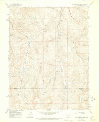
1964 Map of Big Foundation Creek
USGS Topo · Published 1968About this map
Oil Spring Mountain and the high ridges of the Piceance Basin define this mid-century landscape on the border of Rio Blanco and Garfield Counties. The 1960s terrain is marked by the early infrastructure of resource extraction and telecommunications, featuring a Radio Facility and Dome in the southern portion of the quadrangle. A network of Jeep Trails and a Pipeline Road wind through deep drainages like West Canyon and Sawmill Canyon, illustrating how the region's energy-related development was beginning to overlay the older ranching and natural landscape.
Find a feature on this map
28 named features on this map. Tap any name to fly to it.
Don’t see what you’re looking for? This feature index may not catch every label — zoom into the map to look around manually.
Map Details
Editions of this 1964 Big Foundation Creek Map
2 editions found
Other maps of this area

1956 · Grand Junction
USGS Topo · 1:250,000

1959 · Grand Junction
USGS Topo · 1:250,000

1960 · Grand Junction
USGS Topo · 1:250,000

1962 · Grand Junction
USGS Topo · 1:250,000

1964 · Grand Junction
USGS Topo · 1:250,000

1964 · Texas Creek
USGS Topo · 1:24,000

1964 · Douglas Pass
USGS Topo · 1:24,000

1964 · Brushy Point
USGS Topo · 1:24,000

1964 · East Evacuation Creek
USGS Topo · 1:24,000
1964 · White Coyote Draw
USGS Topo · 1:24,000