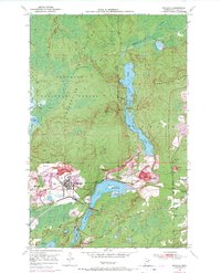
1950 Map of Biwabik
USGS Topo · Published 1971About this map
Biwabik Mine and the Embarrass Mine define the industrial footprint of this Mesabi Range landscape, where the extraction of iron ore transformed the terrain into a complex of open pits and massive mine dumps. The city of Biwabik and the neighboring settlements of Pineville, Belgrade, and Aurora are closely integrated with these operations, many of which are linked by the Duluth Missabe and Iron Range railroad. North of the heavy industry, the Superior National Forest encompasses the Embarrass Mts and the Laurentian Divide, where waters split between the Hudson Bay and Lake Superior basins. A chain of lakes including Sabin Lake, Wynne Lake, and Embarrass Lake provides a sharp contrast to the nearby Hudson Pit and Canton Mine, reflecting the dual character of a region defined by both its natural hydrology and intensive mineral production.
Find a feature on this map
47 named features on this map. Tap any name to fly to it.
Don’t see what you’re looking for? This feature index may not catch every label — zoom into the map to look around manually.
Map Details
Editions of this 1950 Biwabik Map
5 editions found
Other maps of this area

1949 · Aurora
USGS Topo · 1:24,000

1949 · Embarrass
USGS Topo · 1:24,000

1950 · Embarrass
USGS Topo · 1:24,000

1950 · Aurora
USGS Topo · 1:24,000

1950 · Biwabik
USGS Topo · 1:24,000

1950 · Mc Kinley
USGS Topo · 1:24,000

1950 · Biwabik NW
USGS Topo · 1:24,000

1950 · Biwabik NE
USGS Topo · 1:24,000

1951 · Biwabik
USGS Topo · 1:24,000

1951 · Mc Kinley
USGS Topo · 1:24,000