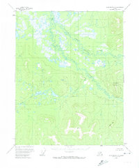
1956 Map of Black River A-2
USGS Topo · Published 1974About this map
Grayling Fork Black River and Bull Creek dominate this 1950s interior landscape, where complex braided water systems wind through extensive wetlands. This survey provides a record of the region before significant modern change, showing a territory defined by its natural drainage and isolated landmarks. Small Cabins tucked away in the upper reaches suggest the seasonal presence of trappers or hunters in an otherwise wild terrain.
Find a feature on this map
7 named features on this map. Tap any name to fly to it.
Don’t see what you’re looking for? This feature index may not catch every label — zoom into the map to look around manually.
Map Details
Editions of this 1956 Black River A-2 Map
3 editions found
Other maps of this area

1951 · Charley River
USGS Topo · 1:250,000

1951 · Black River
USGS Topo · 1:250,000
1956 · Black River A-1
USGS Topo · 1:63,360

1956 · Black River A-2
USGS Topo · 1:63,360

1956 · Black River B-3
USGS Topo · 1:63,360

1956 · Black River B-2
USGS Topo · 1:63,360

1956 · Black River B-1
USGS Topo · 1:63,360

1956 · Black River A-3
USGS Topo · 1:63,360

1956 · Charley River D-3
USGS Topo · 1:63,360

1956 · Black River
USGS Topo · 1:250,000