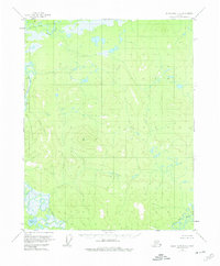
1956 Map of Black River B-3
USGS Topo · Published 1974About this map
The Black River and its major tributaries dominate this mid-century subarctic landscape, where the confluence of the Salmon Fork Black River and the Grayling Fork Black River defines a vast, undeveloped drainage system. Surveyed via aerial photography in 1955, the terrain is a complex network of wetlands and wandering watercourses, notably punctuated by the large expanse of Whitefish Lake in the southwest. High points in the topography are rare, with the prominent The Reef and the triangulation point at VABM Orange 2141 serving as the primary landmarks in an otherwise low-lying basin. The map records the interior of Alaska during an era of systematic USGS photogrammetric mapping, documenting the natural hydrologic patterns before any roads or permanent settlements were established in this specific sector.
Find a feature on this map
6 named features on this map. Tap any name to fly to it.
Don’t see what you’re looking for? This feature index may not catch every label — zoom into the map to look around manually.
Map Details
Editions of this 1956 Black River B-3 Map
3 editions found
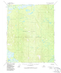
Other maps of this area

1951 · Black River
USGS Topo · 1:250,000

1956 · Black River A-2
USGS Topo · 1:63,360

1956 · Black River A-4
USGS Topo · 1:63,360

1956 · Black River B-3
USGS Topo · 1:63,360

1956 · Black River B-2
USGS Topo · 1:63,360

1956 · Black River A-3
USGS Topo · 1:63,360

1956 · Black River B-4
USGS Topo · 1:63,360

1956 · Black River C-2
USGS Topo · 1:63,360

1956 · Black River C-4
USGS Topo · 1:63,360

1956 · Black River C-3
USGS Topo · 1:63,360