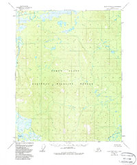
1956 Map of Black River B-3
USGS Topo · Published 1988About this map
The Salmon Fork Black River and the Black River dominate this interior landscape, weaving through the expansive Yukon Flats of eastern Alaska. Mapped from aerial photography in the mid-1950s, the terrain is defined by a dense network of meandering waterways, wetlands, and small lakes characteristic of this alluvial basin. The absence of roads or permanent structures on the sheet reflects the wilderness character of the region, which is largely contained within the National Wildlife Refuge. In the southwest corner, the map shows Whitefish Lake situated along the river's path, while the Grayling Fork Black River enters from the southeast. This survey provides a baseline view of the complex river systems before the minor revisions of the late 1980s, serving as a critical reference for understanding the hydrological patterns of the northern refuge.
Find a feature on this map
6 named features on this map. Tap any name to fly to it.
Don’t see what you’re looking for? This feature index may not catch every label — zoom into the map to look around manually.
Map Details
Editions of this 1956 Black River B-3 Map
3 editions found
Other maps of this area

1951 · Black River
USGS Topo · 1:250,000

1956 · Black River A-2
USGS Topo · 1:63,360

1956 · Black River A-4
USGS Topo · 1:63,360

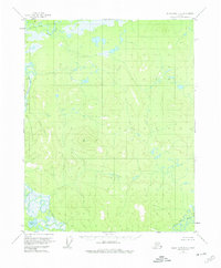
1956 · Black River B-3
USGS Topo · 1:63,360

1956 · Black River B-2
USGS Topo · 1:63,360

1956 · Black River A-3
USGS Topo · 1:63,360

1956 · Black River B-4
USGS Topo · 1:63,360

1956 · Black River C-2
USGS Topo · 1:63,360

1956 · Black River C-4
USGS Topo · 1:63,360

1956 · Black River C-3
USGS Topo · 1:63,360