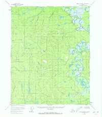
1956 Map of Black River B-4
USGS Topo · Published 1972About this map
The Black River meanders through this interior Alaska landscape, defining a complex network of wetlands and oxbows during the mid-1950s. The eastern portion of the quadrangle is dominated by the river's shifting course, where Salmon Slough and numerous unnamed ponds indicate a dynamic hydrologic environment. Evidence of seasonal or remote habitation is found along the riverbanks, most notably the Cabins located near the southeastern corner of the sheet. Inland from the main channel, bodies of water such as Birch Lake and Tommy Lake sit amidst a terrain of varied elevation, captured here through photogrammetric methods from 1955 aerial photography. This survey illustrates the remote character of the Yukon-Koyukuk region before significant modern alteration, preserving the original wilderness placement of water features and isolated structures.
Find a feature on this map
5 named features on this map. Tap any name to fly to it.
Don’t see what you’re looking for? This feature index may not catch every label — zoom into the map to look around manually.
Map Details
Editions of this 1956 Black River B-4 Map
2 editions found
Other maps of this area

1951 · Black River
USGS Topo · 1:250,000

1956 · Black River A-4
USGS Topo · 1:63,360

1956 · Black River B-5
USGS Topo · 1:63,360

1956 · Black River B-3
USGS Topo · 1:63,360

1956 · Black River A-3
USGS Topo · 1:63,360

1956 · Black River B-4
USGS Topo · 1:63,360

1956 · Black River C-5
USGS Topo · 1:63,360

1956 · Black River C-4
USGS Topo · 1:63,360

1956 · Black River C-3
USGS Topo · 1:63,360
1956 · Black River A-5
USGS Topo · 1:63,360