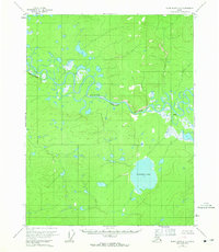
1956 Map of Black River C-5
USGS Topo · Published 1965About this map
Black River meanders through this interior Alaska landscape, defined by a complex network of wetlands and oxbow lakes documented in the mid-1950s. The presence of Doghouse Cabin along the northern riverbank provides a rare point of human habitation in a region primarily shaped by water and elevation changes. To the south, the expansive Tiinkdhul Lake dominates the terrain, surrounded by a maze of smaller ponds and marshland. The survey records specific navigational and geological markers such as Deadman Riffle and the prominent Red Bluff, which rises along the western bend of the river. This map captures the unorganized territory before significant modernization, where names like Dahteh identify local landmarks amidst the dense hydrological features of the Yukon-Koyukuk region.
Find a feature on this map
6 named features on this map. Tap any name to fly to it.
Don’t see what you’re looking for? This feature index may not catch every label — zoom into the map to look around manually.
Map Details
Editions of this 1956 Black River C-5 Map
3 editions found
Other maps of this area

1951 · Black River
USGS Topo · 1:250,000

1956 · Black River B-6
USGS Topo · 1:63,360

1956 · Black River D-6
USGS Topo · 1:63,360

1956 · Black River B-5
USGS Topo · 1:63,360

1956 · Black River D-4
USGS Topo · 1:63,360

1956 · Black River D-5
USGS Topo · 1:63,360

1956 · Black River C-6
USGS Topo · 1:63,360

1956 · Black River B-4
USGS Topo · 1:63,360

1956 · Black River C-5
USGS Topo · 1:63,360

1956 · Black River C-4
USGS Topo · 1:63,360