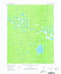
1956 Map of Black River C-5
USGS Topo · Published 1980About this map
The meandering course of the Black River dominates this mid-century landscape in the Yukon-Koyukuk region. In this unroaded wilderness, the river serves as the primary artery for navigation and life, marked by distinct riverine landmarks such as Deadman Riffle and the prominent Red Bluff. The presence of Doghouse Cabin along the northern banks suggests a seasonal or functional outpost in an otherwise sparsely populated interior. To the south, the terrain transitions into a flatter basin characterized by significant water bodies like Tiinkdhul Lake, reflecting the complex hydrological network of the Alaskan bush before modern development. This document captures the traditional names and isolated landmarks of the territory as they were recorded during the mid-1950s field surveys.
Find a feature on this map
6 named features on this map. Tap any name to fly to it.
Don’t see what you’re looking for? This feature index may not catch every label — zoom into the map to look around manually.
Map Details
Editions of this 1956 Black River C-5 Map
3 editions found
Other maps of this area

1951 · Black River
USGS Topo · 1:250,000

1956 · Black River B-6
USGS Topo · 1:63,360

1956 · Black River D-6
USGS Topo · 1:63,360

1956 · Black River B-5
USGS Topo · 1:63,360

1956 · Black River D-4
USGS Topo · 1:63,360

1956 · Black River D-5
USGS Topo · 1:63,360

1956 · Black River C-6
USGS Topo · 1:63,360

1956 · Black River B-4
USGS Topo · 1:63,360

1956 · Black River C-5
USGS Topo · 1:63,360

1956 · Black River C-4
USGS Topo · 1:63,360