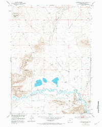
1951 Map of Black Rock Gap
USGS Topo · Published 1984About this map
The Granite Mountains dominate this central Wyoming landscape, creating a jagged horizon above the expansive Agate Flats. This 1951 field-checked survey reveals a complex hydrological network where the Sweetwater River meanders through the southern portion of the quadrangle, flanked by numerous irrigation channels and a notable Ditch. Further north, the presence of the Soda Lakes indicates the alkaline nature of the basins in this arid region.
Find a feature on this map
15 named features on this map. Tap any name to fly to it.
Don’t see what you’re looking for? This feature index may not catch every label — zoom into the map to look around manually.
Map Details
Editions of this 1951 Black Rock Gap Map
5 editions found
Other maps of this area

1951 · Crooks Creek NE
USGS Topo · 1:24,000

1951 · Stampede Meadow
USGS Topo · 1:24,000

1951 · Black Rock Gap
USGS Topo · 1:24,000

1951 · Split Rock
USGS Topo · 1:24,000

1951 · Split Rock NW
USGS Topo · 1:24,000

1951 · Lankin Dome
USGS Topo · 1:24,000

1952 · Muskrat Basin
USGS Topo · 1:24,000

1952 · Coyote Springs
USGS Topo · 1:24,000

1952 · Mc Intosh Meadows
USGS Topo · 1:24,000

1955 · Casper
USGS Topo · 1:250,000