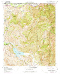
1967 Map of Black Star Canyon
USGS Topo · Published 1974About this map
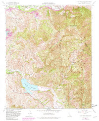
The Santa Ana Mountains dominate this 1967 landscape, showcasing the steep drainage systems of Black Star Canyon and Fremont Canyon as they descend toward the Santa Ana River. This period of the late 1960s captures the region's industrial and recreational layers before intense suburban expansion. Evidence of the area's resource extraction is visible through the Santiago Coal Mine and Black Star Coal Mine, while the modern era is represented by the Rocket Fuels Test Site tucked into Gypsum Canyon.
Find a feature on this map
45 named features on this map. Tap any name to fly to it.
Don’t see what you’re looking for? This feature index may not catch every label — zoom into the map to look around manually.
Map Details
Editions of this 1967 Black Star Canyon Map
7 editions found
Other maps of this area

1896 · Santa Ana
USGS Topo · 1:62,500

1896 · Anaheim
USGS Topo · 1:62,500

1898 · Anaheim
USGS Topo · 1:62,500

1901 · Southern California Sheet No. 1
USGS Topo · 1:250,000

1901 · Santa Ana
USGS Topo · 1:62,500

1901 · Anaheim
USGS Topo · 1:62,500

1902 · Corona
USGS Topo · 1:125,000

1904 · Southern California Sheet No. 1
USGS Topo · 1:250,000

1932 · Orange
USGS Topo · 1:31,680

1932 · Tustin
USGS Topo · 1:31,680