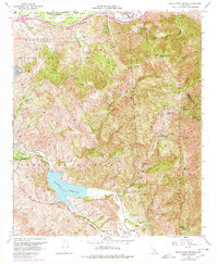
1967 Map of Black Star Canyon
USGS Topo · Published 1978About this map
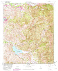
Santiago Reservoir dominates the lower southwest of this landscape, fed by the waters of Santiago Creek and held by the Santiago Dam. The terrain is defined by the steep canyons of the Santa Ana Mountains, where the Cleveland National Forest meets private ranching and industrial interests. Resource extraction is a visible legacy here, with the Claymont Clay Mine, Santiago Coal Mine, and Black Star Coal Mine marking the hillsides.
Find a feature on this map
46 named features on this map. Tap any name to fly to it.
Don’t see what you’re looking for? This feature index may not catch every label — zoom into the map to look around manually.
Map Details
Editions of this 1967 Black Star Canyon Map
7 editions found
Other maps of this area

1896 · Santa Ana
USGS Topo · 1:62,500

1896 · Anaheim
USGS Topo · 1:62,500

1898 · Anaheim
USGS Topo · 1:62,500

1901 · Southern California Sheet No. 1
USGS Topo · 1:250,000

1901 · Santa Ana
USGS Topo · 1:62,500

1901 · Anaheim
USGS Topo · 1:62,500

1902 · Corona
USGS Topo · 1:125,000

1904 · Southern California Sheet No. 1
USGS Topo · 1:250,000

1932 · Orange
USGS Topo · 1:31,680

1932 · Tustin
USGS Topo · 1:31,680