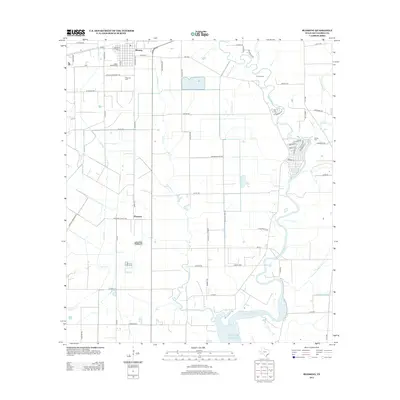
2013 Map of Blessing
USGS Topo · Published 2013About this map
Blessing and the nearby locality of Pheasant anchor this coastal Texas landscape, where the flat coastal prairie meets the winding Tres Palacios River. This 2013 survey depicts a region defined by its water management and agricultural infrastructure, evidenced by the intricate network of drainage features like Johnsons Timber Slough, Compress Slough, and Willow Dam Slough. These waterways eventually drain toward the Gulf of Mexico, illustrating the low-elevation hydrology of Matagorda County. For those researching local heritage, the map identifies several distinct burial grounds, including Blessing Cem, Grimes Cem, and Ashby Cem. The transportation network is a mix of state-maintained routes like F-M 2853 and locally named roads such as Fig Farm Rd and Texaco Rd, which follow the rigid grid of the surrounding fields and pastures.
Find a feature on this map
68 named features on this map. Tap any name to fly to it.
Don’t see what you’re looking for? This feature index may not catch every label — zoom into the map to look around manually.
Map Details
Editions of this 2013 Blessing Map
This is the sole edition of this map. No revisions or reprints were ever made.
Other maps of this area

1952 · Blessing SE
USGS Topo · 1:24,000

1952 · Palacios
USGS Topo · 1:24,000

1952 · Turtle Bay
USGS Topo · 1:24,000

1952 · Francitas
USGS Topo · 1:24,000

1952 · Blessing
USGS Topo · 1:24,000

1952 · Markham
USGS Topo · 1:24,000

1952 · Francitas NE
USGS Topo · 1:24,000

1952 · Midfield
USGS Topo · 1:24,000

1952 · Palacios NE
USGS Topo · 1:24,000

1953 · Beeville
USGS Topo · 1:250,000