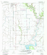
1972 Map of Blessing
USGS Topo · Published 1985About this map
The town of Blessing serves as the focal point of this coastal prairie landscape, where the intersection of the Missouri Pacific and Southern Pacific railroads once drove the local economy. Established during the early 20th-century land booms, the area maintains a distinct agricultural and industrial character, evidenced by the Gas Plant and a network of irrigation levees. The terrain is defined by the winding course of the Tres Palacios River as it snakes toward Tres Palacios Bay, creating a complex system of drainage features like Compress Slough and Johnson Slough. For family historians, the map preserves the locations of vital community landmarks, including the Blessing Cem, Grimes Cem, and Ashby Cem, alongside the Blessing Sch and the Prairie Center Mission located further south near the small siding of Pheasant.
Find a feature on this map
19 named features on this map. Tap any name to fly to it.
Don’t see what you’re looking for? This feature index may not catch every label — zoom into the map to look around manually.
Map Details
Editions of this 1972 Blessing Map
This is the sole edition of this map. No revisions or reprints were ever made.
Other maps of this area

1952 · Blessing SE
USGS Topo · 1:24,000

1952 · Palacios
USGS Topo · 1:24,000

1952 · Turtle Bay
USGS Topo · 1:24,000

1952 · Francitas
USGS Topo · 1:24,000

1952 · Blessing
USGS Topo · 1:24,000

1952 · Markham
USGS Topo · 1:24,000

1952 · Francitas NE
USGS Topo · 1:24,000

1952 · Midfield
USGS Topo · 1:24,000

1952 · Palacios NE
USGS Topo · 1:24,000

1953 · Beeville
USGS Topo · 1:250,000