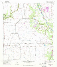
1952 Map of Blessing SE
USGS Topo · Published 1976About this map
The Colorado River winds through this coastal Texas landscape, defining a network of wetlands and agricultural tracts in Matagorda County. Near the western edge, the rural settlements of Tin Top and the vicinity of Ashby Ch serve as local anchors for a community shaped by its waterways. The terrain is marked by significant drainage and irrigation infrastructure, including an Abandoned Canal and an Old Railroad Grade that speak to shifting transportation and water management needs during the mid-20th century.
Find a feature on this map
18 named features on this map. Tap any name to fly to it.
Don’t see what you’re looking for? This feature index may not catch every label — zoom into the map to look around manually.
Map Details
Editions of this 1952 Blessing SE Map
2 editions found
Other maps of this area

1951 · Bay City
USGS Topo · 1:250,000

1952 · Matagorda
USGS Topo · 1:24,000

1952 · Blessing SE
USGS Topo · 1:24,000

1952 · Palacios
USGS Topo · 1:24,000

1952 · Blessing
USGS Topo · 1:24,000

1952 · Bay City
USGS Topo · 1:24,000

1952 · Markham
USGS Topo · 1:24,000

1952 · Midfield
USGS Topo · 1:24,000

1952 · Palacios NE
USGS Topo · 1:24,000

1952 · Wadsworth
USGS Topo · 1:24,000