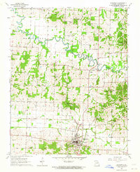
1963 Map of Bloomfield
USGS Topo · Published 1964About this map
Bloomfield serves as the focal point of this Stoddard County landscape, situated amidst a complex network of drainage canals and meandering waterways. The winding course of the Castor River dominates the northern half of the territory, while the southern reach is defined by systematic engineering, including the Lick Creek Ditch and the waters of Tedrick Creek. This era of development is marked by the presence of an Old Railroad Grade cutting across the landscape toward the river, reflecting the transition from rail-dependent industry to the road networks seen today.
Find a feature on this map
43 named features on this map. Tap any name to fly to it.
Don’t see what you’re looking for? This feature index may not catch every label — zoom into the map to look around manually.
Map Details
Editions of this 1963 Bloomfield Map
3 editions found
Other maps of this area

1934 · Bloomfield
USGS Topo · 1:62,500

1934 · Advance
USGS Topo · 1:62,500

1934 · Puxico
USGS Topo · 1:62,500

1935 · Zalma
USGS Topo · 1:62,500

1939 · Bloomfield
USGS Topo · 1:62,500

1939 · Advance
USGS Topo · 1:62,500

1939 · Puxico
USGS Topo · 1:62,500

1939 · Zalma
USGS Topo · 1:62,500

1949 · Paducah
USGS Topo · 1:250,000

1949 · Rolla
USGS Topo · 1:250,000