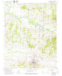
1963 Map of Bloomfield
USGS Topo · Published 1979About this map
Bloomfield serves as the regional hub in this topographical portrait of Stoddard County, Missouri, during the early 1960s. The landscape is defined by the winding course of the Castor River, which transitions from a natural waterway into engineered drainage systems like Lick Creek Ditch. This era reflects a transition in transportation, marked by an abandoned Railroad Grade that once connected these rural communities.
Find a feature on this map
36 named features on this map. Tap any name to fly to it.
Don’t see what you’re looking for? This feature index may not catch every label — zoom into the map to look around manually.
Map Details
Editions of this 1963 Bloomfield Map
3 editions found
Other maps of this area

1934 · Bloomfield
USGS Topo · 1:62,500

1934 · Advance
USGS Topo · 1:62,500

1934 · Puxico
USGS Topo · 1:62,500

1935 · Zalma
USGS Topo · 1:62,500

1939 · Bloomfield
USGS Topo · 1:62,500

1939 · Advance
USGS Topo · 1:62,500

1939 · Puxico
USGS Topo · 1:62,500

1939 · Zalma
USGS Topo · 1:62,500

1949 · Paducah
USGS Topo · 1:250,000

1949 · Rolla
USGS Topo · 1:250,000