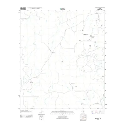
2012 Map of Blowout
USGS Topo · Published 2012About this map
The settlement of Blowout anchors this portion of the Texas Hill Country, where family-named landmarks and historical burial grounds reflect the deep roots of Blanco County ranching life. Rural roads like A Davis Ranch Rd and Althaus Davis Rd wind through a landscape defined by prominent rises such as the Smith Mountains, Indian Peak, and Tabletop Mtn. The hydrology of the area is particularly noteworthy, with numerous water sources like Comanche Spring, Blackjack Spring, and Sultemeier Springs feeding into a network of creeks including White Cr and Comanche Cr. Genealogists and local historians can locate the Comanche Cem and Davis Cem, providing specific points of reference for the families that settled this area. From the elevations of Coon Mtn to the low expanse of Rattlesnake Flat, the map reveals the varied topography that dictated the placement of early homesteads and stock trails.
Find a feature on this map
51 named features on this map. Tap any name to fly to it.
Don’t see what you’re looking for? This feature index may not catch every label — zoom into the map to look around manually.
Map Details
Editions of this 2012 Blowout Map
This is the sole edition of this map. No revisions or reprints were ever made.
Other maps of this area

1887 · Llano
USGS Topo · 1:125,000

1887 · Blanco
USGS Topo · 1:125,000

1887 · Burnet
USGS Topo · 1:125,000

1893 · Burnet
USGS Topo · 1:125,000

1894 · Fredericksburg
USGS Topo · 1:125,000

1894 · Blanco
USGS Topo · 1:125,000

1894 · Llano
USGS Topo · 1:125,000

1903 · Burnet
USGS Topo · 1:125,000

1904 · Llano
USGS Topo · 1:125,000

1909 · Llano
USGS Topo · 1:125,000