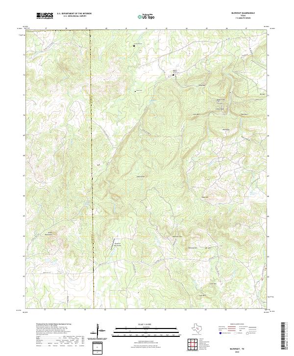
2022 Map of Blowout
USGS Topo · Published 2022About this map
The Gillespie Co Blanco Co line bisects this portion of the Texas Hill Country, defining a landscape of high limestone ridges and deeply etched spring basins. Family heritage is anchored by secluded burial sites like the Roberts - Shelley - Hardin Cem and Comanche Cem, which sit among the headwaters of Comanche Cr and White Cr. The terrain is characterized by distinctive summits including Tabletop Mtn, Coon Mtn, and Smith Mountains. Settlement patterns are sparse, with the Hauptrief Aero Airport and ranch roads like Ranch Rd 1323 providing the primary modern interventions. The area's hydrology is particularly dense, with Sultemeier Springs and Blackjack Spring feeding a complex network of seasonal branches that have long dictated the placement of homesteads and cattle operations.
Find a feature on this map
50 named features on this map. Tap any name to fly to it.
Don’t see what you’re looking for? This feature index may not catch every label — zoom into the map to look around manually.
Map Details
Editions of this 2022 Blowout Map
This is the sole edition of this map. No revisions or reprints were ever made.
Other maps of this area

1887 · Llano
USGS Topo · 1:125,000

1887 · Blanco
USGS Topo · 1:125,000

1887 · Burnet
USGS Topo · 1:125,000

1893 · Burnet
USGS Topo · 1:125,000

1894 · Fredericksburg
USGS Topo · 1:125,000

1894 · Blanco
USGS Topo · 1:125,000

1894 · Llano
USGS Topo · 1:125,000

1903 · Burnet
USGS Topo · 1:125,000

1904 · Llano
USGS Topo · 1:125,000

1909 · Llano
USGS Topo · 1:125,000