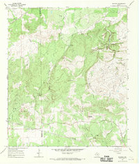
1967 Map of Blowout
USGS Topo · Published 1970About this map
Blowout sits at the heart of this central Texas landscape, where the Gillespie Co Blanco Co line divides a terrain defined by high ridges and narrow creek bottoms. The local geography is anchored by prominent elevations such as Pond Mountain, Indian Peak, and the Smith Mountains, while the namesake Blowout Cave suggests the karst nature of the Edwards Plateau. Water sources were clearly vital to the small settlements and ranches of the late 1960s, evidenced by named features like Comanche Spring, Blackjack Spring, and the branching waters of Comanche Creek and White Creek.
Find a feature on this map
43 named features on this map. Tap any name to fly to it.
Don’t see what you’re looking for? This feature index may not catch every label — zoom into the map to look around manually.
Map Details
Editions of this 1967 Blowout Map
This is the sole edition of this map. No revisions or reprints were ever made.
Other maps of this area

1887 · Llano
USGS Topo · 1:125,000

1887 · Blanco
USGS Topo · 1:125,000

1887 · Burnet
USGS Topo · 1:125,000

1893 · Burnet
USGS Topo · 1:125,000

1894 · Fredericksburg
USGS Topo · 1:125,000

1894 · Blanco
USGS Topo · 1:125,000

1894 · Llano
USGS Topo · 1:125,000

1903 · Burnet
USGS Topo · 1:125,000

1904 · Llano
USGS Topo · 1:125,000

1909 · Llano
USGS Topo · 1:125,000