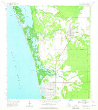
1958 Map of Bonita Springs
USGS Topo · Published 1965About this map
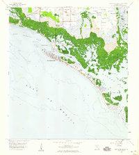
Bonita Springs sits at the heart of this coastal transition in the late 1950s, where the Imperial River and Spring Creek wind through mangrove-lined estuaries toward Estero Bay. This survey captures the region just as modern development began to shape the shoreline, contrasting established areas like Council with the emerging grid of Naples Park. The landscape is defined by a complex network of waterways, including Little Hickory Bay and the Cocohatchee River, which flow out to the Gulf of Mexico through Wiggins Pass. Local landmarks of the era include the Crest Lawn Cem, a Drive-in Theater, and a Racetrack located south of Oak Creek. The Atlantic Coast Line railroad runs parallel to the coast, providing a vital transportation spine through the developing Lee and Collier county borderlands.
Find a feature on this map
25 named features on this map. Tap any name to fly to it.
Don’t see what you’re looking for? This feature index may not catch every label — zoom into the map to look around manually.
Map Details
Editions of this 1958 Bonita Springs Map
5 editions found
Other maps of this area

1956 · West Palm Beach
USGS Topo · 1:250,000

1957 · West Palm Beach
USGS Topo · 1:250,000

1958 · West Palm Beach
USGS Topo · 1:250,000

1958 · Bonita Springs
USGS Topo · 1:24,000

1958 · Corkscrew NW
USGS Topo · 1:24,000

1958 · Estero
USGS Topo · 1:24,000

1958 · Belle Meade NW
USGS Topo · 1:24,000

1958 · Corkscrew SW
USGS Topo · 1:24,000
1958 · Fort Myers Beach
USGS Topo · 1:24,000

1958 · Naples North
USGS Topo · 1:24,000