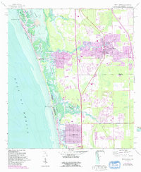
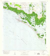
1958 Map of Bonita Springs
USGS Topo · Published 1991About this map
The Imperial River and Cocohatchee River dominate this coastal landscape, flowing through a complex network of mangrove-lined estuaries into the Gulf of Mexico. The transition of Southwest Florida is evident in the burgeoning residential grids of Bonita Springs, Bonita Shores, and Naples Park. These mid-century developments appear alongside older traces of the region's transport history, such as the Old RR Grade running parallel to the coastline.
Find a feature on this map
29 named features on this map. Tap any name to fly to it.
Don’t see what you’re looking for? This feature index may not catch every label — zoom into the map to look around manually.
Map Details
Editions of this 1958 Bonita Springs Map
5 editions found
Other maps of this area

1956 · West Palm Beach
USGS Topo · 1:250,000

1957 · West Palm Beach
USGS Topo · 1:250,000

1958 · West Palm Beach
USGS Topo · 1:250,000

1958 · Bonita Springs
USGS Topo · 1:24,000

1958 · Corkscrew NW
USGS Topo · 1:24,000

1958 · Estero
USGS Topo · 1:24,000

1958 · Belle Meade NW
USGS Topo · 1:24,000

1958 · Corkscrew SW
USGS Topo · 1:24,000
1958 · Fort Myers Beach
USGS Topo · 1:24,000

1958 · Naples North
USGS Topo · 1:24,000