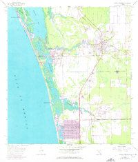
1958 Map of Bonita Springs
USGS Topo · Published 1973About this map
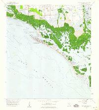
The Imperial River and Cocohatchee River wind through a complex system of mangroves and tidal basins on this southwest Florida coastal survey. During this mid-century period, the transition from old Florida settlements to modern development is visible in the grid of Naples Park and the emerging tracts of Palm River Estates. The Seaboard Coast Line railroad runs inland, parallel to the coast, passing through the established community of Bonita Springs.
Find a feature on this map
23 named features on this map. Tap any name to fly to it.
Don’t see what you’re looking for? This feature index may not catch every label — zoom into the map to look around manually.
Map Details
Editions of this 1958 Bonita Springs Map
5 editions found
Other maps of this area

1956 · West Palm Beach
USGS Topo · 1:250,000

1957 · West Palm Beach
USGS Topo · 1:250,000

1958 · West Palm Beach
USGS Topo · 1:250,000

1958 · Bonita Springs
USGS Topo · 1:24,000

1958 · Corkscrew NW
USGS Topo · 1:24,000

1958 · Estero
USGS Topo · 1:24,000

1958 · Belle Meade NW
USGS Topo · 1:24,000

1958 · Corkscrew SW
USGS Topo · 1:24,000
1958 · Fort Myers Beach
USGS Topo · 1:24,000

1958 · Naples North
USGS Topo · 1:24,000