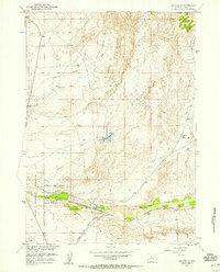
1957 Map of Bonneville
USGS Topo · Published 1958About this map
Chicago Burlington and Quincy and Chicago and North Western rail lines converge at Bonneville, a critical junction in this high desert landscape of Fremont County. The infrastructure here is heavily tied to water and transit, with the Bonneville Reservoir and its Spillway managing the flow of Tough Creek. To the west, the Boysen Reservation Withdrawal Area marks a significant federal land designation during the development of the Missouri River Basin project. The settlement of Siddons and the Shoshoni Airport sit at the southern edge of the quadrangle, while a Gaging Station on Badwater Creek monitors the vital, seasonal water supply. The map records a moment when these two major railroads dominated the valley floor, passing through small stops like Ford to support the regional ranching and transport economy.
Find a feature on this map
16 named features on this map. Tap any name to fly to it.
Don’t see what you’re looking for? This feature index may not catch every label — zoom into the map to look around manually.
Map Details
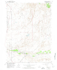
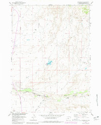
Editions of this 1957 Bonneville Map
3 editions found
Other maps of this area

1950 · Bonneville SW
USGS Topo · 1:24,000

1951 · Boysen
USGS Topo · 1:24,000

1951 · Birdseye Pass
USGS Topo · 1:24,000

1951 · Hidden Valley
USGS Topo · 1:24,000

1951 · Bonneville
USGS Topo · 1:24,000

1951 · Shoshoni
USGS Topo · 1:24,000

1952 · Ocla Draw
USGS Topo · 1:24,000

1952 · Picard Ranch
USGS Topo · 1:24,000

1952 · Guffy Peak
USGS Topo · 1:24,000

1955 · Thermopolis
USGS Topo · 1:250,000