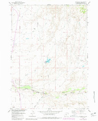
1957 Map of Bonneville
USGS Topo · Published 1980About this map
Bonneville serves as a critical junction for the Chicago and North Western and Burlington Northern railroads, marking this area of Fremont County as a hub for mid-century transportation and shipping. The landscape is defined by the course of Badwater Creek and the man-made Bonneville Reservoir, which features a prominent Spillway. Just to the west, Boysen State Park borders the high desert terrain, where the infrastructure of a Telephone Line and a lonely Windmill highlight the intersection of utility and open range.
Find a feature on this map
14 named features on this map. Tap any name to fly to it.
Don’t see what you’re looking for? This feature index may not catch every label — zoom into the map to look around manually.
Map Details
Editions of this 1957 Bonneville Map
3 editions found
Other maps of this area

1950 · Bonneville SW
USGS Topo · 1:24,000

1951 · Boysen
USGS Topo · 1:24,000

1951 · Birdseye Pass
USGS Topo · 1:24,000

1951 · Hidden Valley
USGS Topo · 1:24,000

1951 · Bonneville
USGS Topo · 1:24,000

1951 · Shoshoni
USGS Topo · 1:24,000

1952 · Ocla Draw
USGS Topo · 1:24,000

1952 · Picard Ranch
USGS Topo · 1:24,000

1952 · Guffy Peak
USGS Topo · 1:24,000

1955 · Thermopolis
USGS Topo · 1:250,000