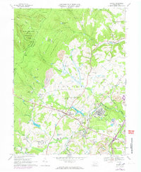
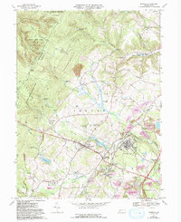
1967 Map of Boswell
USGS Topo · Published 1973About this map
The industrial and recreational geography of central Somerset County is clearly visible here, defined by the extraction of coal and the management of water resources. Extensive Strip Mines and several Gas Wells surround the borough of Boswell, where the Baltimore and Ohio railroad corridor facilitates the transport of resources through Coal Junction. This landscape is one of transitions, where the steep, wooded heights of Laurel Hill and State Game Lands No 42 give way to a valley floor dotted with historic rural settlements like Jennertown, Ferrellton, and Forwardstown.
Find a feature on this map
74 named features on this map. Tap any name to fly to it.
Don’t see what you’re looking for? This feature index may not catch every label — zoom into the map to look around manually.
Map Details
Editions of this 1967 Boswell Map
5 editions found
Other maps of this area

1904 · Johnstown
USGS Topo · 1:62,500

1907 · Johnstown
USGS Topo · 1:62,500

1913 · Somerset
USGS Topo · 1:62,500

1914 · Windber
USGS Topo · 1:62,500

1915 · Somerset
USGS Topo · 1:62,500

1916 · Windber
USGS Topo · 1:62,500

1920 · New Florence
USGS Topo · 1:62,500

1921 · New Florence
USGS Topo · 1:48,000

1922 · New Florence
USGS Topo · 1:62,500

1944 · Somerset
USGS Topo · 1:62,500