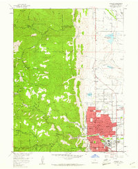
1957 Map of Boulder
USGS Topo · Published 1961About this map
Boulder and its mountain backdrop are documented here in the late 1950s, showing the city's development alongside the legacy of Front Range mining. The University of Colorado campus anchors the southern edge of town, while the urban grid extends toward Wonderland Lake. To the west, the landscape shifts abruptly into the Roosevelt National Forest, where steep canyons like Fourmile Creek and Bummers Gulch are dotted with numerous historic mining operations.
Find a feature on this map
71 named features on this map. Tap any name to fly to it.
Don’t see what you’re looking for? This feature index may not catch every label — zoom into the map to look around manually.
Map Details
Editions of this 1957 Boulder Map
3 editions found
Other maps of this area

1899 · West Denver
USGS Topo · 1:125,000

1902 · Boulder
USGS Topo · 1:62,500

1904 · Niwot
USGS Topo · 1:62,500

1904 · Boulder
USGS Topo · 1:62,500

1906 · Blackhawk
USGS Topo · 1:62,500

1942 · Eldorado Springs
USGS Topo · 1:24,000

1942 · Louisville
USGS Topo · 1:31,680

1942 · Tungsten
USGS Topo · 1:24,000

1944 · Eldorado Springs
USGS Topo · 1:31,680
1944 · Tungsten
USGS Topo · 1:31,680