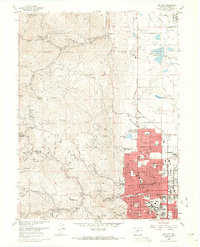
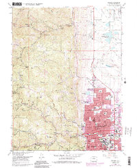
1966 Map of Boulder
USGS Topo · Published 1968About this map
Boulder serves as the focal point of this 1960s study, showcasing a period of significant educational and scientific growth. The expansive campus of the University of Colorado is a prominent fixture, featuring Folsom Field and the university Observatory. On the city's outskirts, the scientific footprint extends to a series of Radio Telescopes near Fourmile Canyon. The map reveals the transition from the dense urban grid of the city to the steep topography of Boulder Mountain Park and the Roosevelt National Forest.
Find a feature on this map
75 named features on this map. Tap any name to fly to it.
Don’t see what you’re looking for? This feature index may not catch every label — zoom into the map to look around manually.
Map Details
Editions of this 1966 Boulder Map
5 editions found
Other maps of this area

1899 · West Denver
USGS Topo · 1:125,000

1902 · Boulder
USGS Topo · 1:62,500

1904 · Niwot
USGS Topo · 1:62,500

1904 · Boulder
USGS Topo · 1:62,500

1906 · Blackhawk
USGS Topo · 1:62,500

1942 · Eldorado Springs
USGS Topo · 1:24,000

1942 · Louisville
USGS Topo · 1:31,680

1942 · Tungsten
USGS Topo · 1:24,000

1944 · Eldorado Springs
USGS Topo · 1:31,680
1944 · Tungsten
USGS Topo · 1:31,680