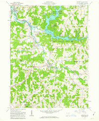
1961 Map of Bowerston
USGS Topo · Published 1963About this map
The industrial and hydrological development of the Carroll and Harrison County line is clearly visible in the early 1960s. Leesville Reservoir, managed by the Muskingum Watershed Conservancy District, dominates the northern landscape, created by the Leesville Dam. The surrounding terrain of the Dohrman Grant is heavily marked by extraction, showing numerous Strip Mines, Oil Wells, and a significant Claypit near Bowerston.
Find a feature on this map
45 named features on this map. Tap any name to fly to it.
Don’t see what you’re looking for? This feature index may not catch every label — zoom into the map to look around manually.
Map Details
Editions of this 1961 Bowerston Map
3 editions found
Other maps of this area

1902 · Scio
USGS Topo · 1:62,500

1904 · Scio
USGS Topo · 1:62,500

1909 · Uhrichsville
USGS Topo · 1:62,500

1910 · Carrollton
USGS Topo · 1:62,500

1911 · Uhrichsville
USGS Topo · 1:62,500

1912 · Dover
USGS Topo · 1:62,500

1912 · Carrollton
USGS Topo · 1:62,500

1944 · Dover
USGS Topo · 1:62,500

1951 · Canton
USGS Topo · 1:250,000

1953 · Canton
USGS Topo · 1:250,000