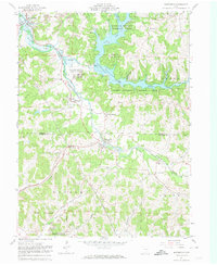
1961 Map of Bowerston
USGS Topo · Published 1974About this map
Leesville Lake dominates this 1961 landscape, its irregular shoreline formed by the flooding of McGuire Creek and its various forks within the Muskingum Watershed Conservancy District. The map records a region defined by complex valley systems and industrial activity, notably the numerous Strip Mines and a Claypit scattered across the hills of Carroll and Harrison counties. Transportation networks follow the natural topography, with the Pennsylvania and New York Chicago and St Louis railroads threading through narrow corridors alongside Conotton Creek.
Find a feature on this map
39 named features on this map. Tap any name to fly to it.
Don’t see what you’re looking for? This feature index may not catch every label — zoom into the map to look around manually.
Map Details
Editions of this 1961 Bowerston Map
3 editions found
Other maps of this area

1902 · Scio
USGS Topo · 1:62,500

1904 · Scio
USGS Topo · 1:62,500

1909 · Uhrichsville
USGS Topo · 1:62,500

1910 · Carrollton
USGS Topo · 1:62,500

1911 · Uhrichsville
USGS Topo · 1:62,500

1912 · Dover
USGS Topo · 1:62,500

1912 · Carrollton
USGS Topo · 1:62,500

1944 · Dover
USGS Topo · 1:62,500

1951 · Canton
USGS Topo · 1:250,000

1953 · Canton
USGS Topo · 1:250,000