
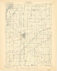
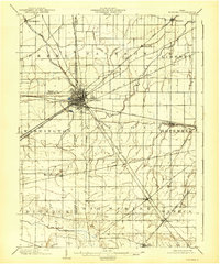
1903 Map of Bowling Green
USGS Topo · Published 1921About this map
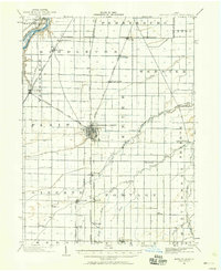
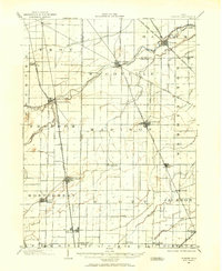
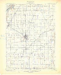
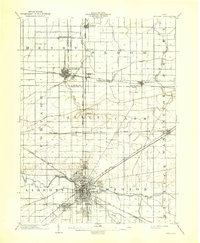
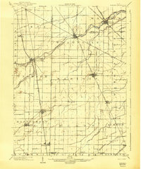
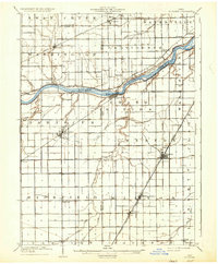
The Wood County landscape near the turn of the century is defined by an intensive network of steam railroads and electric interurbans radiating from Bowling Green. This 1901 survey documents the transition of Northwest Ohio from a frontier clearing to a highly connected agricultural and industrial hub. The Maumee River cuts across the northwest corner near Waterville, while the historic Twelvemile Reservation boundary persists as a legal and geographic marker in the northern townships. The intricate rail infrastructure, including the Toledo Bowling Green and Southern Traction Co. and the Cincinnati Hamilton and Dayton Ry., shows how even small settlements like Tontogany, Haskins, and Rudolph were vital nodes in the regional economy. To the south, the branching headwaters of the Portage River, including Rocky Ford and the South Branch Portage River, drain the flatlands surrounding Jerry City and Mungen.
Find a feature on this map
52 named features on this map. Tap any name to fly to it.
Don’t see what you’re looking for? This feature index may not catch every label — zoom into the map to look around manually.
Map Details
Editions of this 1903 Bowling Green Map
3 editions found
Other maps of this area

1900 · Maumee Bay
USGS Topo · 1:62,500

1900 · Toledo
USGS Topo · 1:62,500

1901 · Fostoria
USGS Topo · 1:62,500
1901 · Bowling Green
USGS Topo · 1:62,500
1901 · Elmore
USGS Topo · 1:62,500
1903 · Bowling Green
USGS Topo · 1:62,500
1903 · Fostoria
USGS Topo · 1:62,500
1903 · Findlay
USGS Topo · 1:62,500
1903 · Elmore
USGS Topo · 1:62,500
1909 · Mc Clure
USGS Topo · 1:62,500