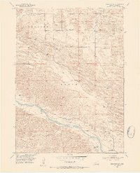
1952 Map of Brewster SE
USGS Topo · Published 1954About this map
Fowler Ranch and other isolated homesteads anchor this 1952 topographic study of the Sandhills region in Blaine County. The landscape is dominated by the winding path of the Middle Loup River, which serves as the primary hydrological feature of the area. Human attempts to manage this water for agriculture are visible in the layout of the Rankin Ditch and the nearby Rankin Ditch (Abandoned), illustrating the challenges of permanent settlement in this semi-arid terrain.
Find a feature on this map
12 named features on this map. Tap any name to fly to it.
Don’t see what you’re looking for? This feature index may not catch every label — zoom into the map to look around manually.
Map Details
Editions of this 1952 Brewster SE Map
3 editions found
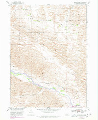
Other maps of this area

1951 · Anselmo NE
USGS Topo · 1:24,000

1951 · Anselmo NW
USGS Topo · 1:24,000

1951 · Milburn
USGS Topo · 1:24,000

1952 · Brewster
USGS Topo · 1:24,000

1952 · Almeria NW
USGS Topo · 1:24,000

1952 · Almeria SW
USGS Topo · 1:24,000

1952 · Brewster SE
USGS Topo · 1:24,000

1952 · Brewster SW
USGS Topo · 1:24,000

1952 · Brewster NW
USGS Topo · 1:24,000

1955 · Broken Bow
USGS Topo · 1:250,000