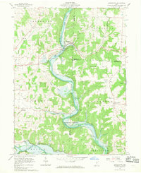
1961 Map of Brinkhaven
USGS Topo · Published 1970About this map
The Mohican River carves a deep path through the rugged hills of central Ohio, marking the border between Knox, Holmes, and Coshocton counties. This 1961 survey captures an active extractive landscape, where an extensive oil field and numerous gas wells punctuate the ridges of Jefferson and Richland townships. The settlement of Brinkhaven serves as a focal point near the river's bend, while the remnants of the Old Railroad Grade and Pennsylvania line trace the historical transport routes that once defined the valley. In the southern reach, the Kokosing River joins the landscape near Zuck, revealing a region transitioning from its industrial peak to recreational use, evidenced by the Mohican River Fishing Area. Small hilltop communities like Tiverton Center and Oak Hill remain anchored by local landmarks such as Riley Chapel and Tiverton Ch.
Find a feature on this map
43 named features on this map. Tap any name to fly to it.
Don’t see what you’re looking for? This feature index may not catch every label — zoom into the map to look around manually.
Map Details
Editions of this 1961 Brinkhaven Map
4 editions found
Other maps of this area

1912 · Loudonville
USGS Topo · 1:62,500

1912 · Gambier
USGS Topo · 1:62,500

1912 · Perrysville
USGS Topo · 1:62,500

1913 · Brinkhaven
USGS Topo · 1:62,500

1914 · Gambier
USGS Topo · 1:62,500

1914 · Loudonville
USGS Topo · 1:62,500

1915 · Brinkhaven
USGS Topo · 1:62,500

1915 · Perrysville
USGS Topo · 1:62,500

1943 · Gambier
USGS Topo · 1:62,500

1943 · Loudonville
USGS Topo · 1:62,500