
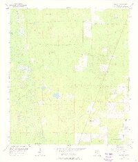
1955 Map of Bronson SE
USGS Topo · Published 1956About this map
Wolf Sink and the nearby Big Wolf Arbor anchor the southern reach of this mid-1950s interior Florida landscape. The terrain is defined by a high density of named water features, reflecting the karst topography and drainage patterns characteristic of the region. Notable bodies such as Fletcher Pond, Hog Pond, and Sage Pond are clustered across the northern half, while Shine Pond, Fourmile Pond, and Fivemile Pond appear toward the east. The drainage system is further marked by the winding courses of Black Prong and Magee Branch. This period of mapping shows a sparsely developed area, largely comprised of wooded wetlands and low ridges before later 20th-century alterations. The presence of numerous named sinks and ponds offers a detailed view of the natural hydrology that dictated the placement of early logging roads and boundary lines like the division between T. 13 S. and T. 14 S. townships.
Find a feature on this map
11 named features on this map. Tap any name to fly to it.
Don’t see what you’re looking for? This feature index may not catch every label — zoom into the map to look around manually.
Map Details
Editions of this 1955 Bronson SE Map
3 editions found
Other maps of this area

1892 · Dunnellon
USGS Topo · 1:62,500

1894 · Dunnellon
USGS Topo · 1:62,500

1895 · Williston
USGS Topo · 1:62,500

1954 · Romeo
USGS Topo · 1:24,000

1954 · Bronson
USGS Topo · 1:24,000

1954 · Bronson SW
USGS Topo · 1:24,000

1954 · Dunnellon
USGS Topo · 1:62,500

1954 · Gainesville
USGS Topo · 1:250,000

1955 · Lebanon Station
USGS Topo · 1:24,000

1955 · Tidewater
USGS Topo · 1:24,000