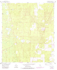
1955 Map of Bronson SE
USGS Topo · Published 1988About this map
Wolf Sink and the surrounding karst-influenced terrain define this portion of Levy County as it appeared during the mid-1950s. The landscape is dominated by a complex network of small depressions and seasonal water bodies, including Deerpen Pond, Hog Pond, and Sage Pond. The presence of Big Wolf Arbor and the drainage of Black Prong suggest a rural, largely undeveloped environment where the natural hydrology dictates the layout of early roads and property lines.
Find a feature on this map
13 named features on this map. Tap any name to fly to it.
Don’t see what you’re looking for? This feature index may not catch every label — zoom into the map to look around manually.
Map Details
Editions of this 1955 Bronson SE Map
3 editions found

Other maps of this area

1892 · Dunnellon
USGS Topo · 1:62,500

1894 · Dunnellon
USGS Topo · 1:62,500

1895 · Williston
USGS Topo · 1:62,500

1954 · Romeo
USGS Topo · 1:24,000

1954 · Bronson
USGS Topo · 1:24,000

1954 · Bronson SW
USGS Topo · 1:24,000

1954 · Dunnellon
USGS Topo · 1:62,500

1954 · Gainesville
USGS Topo · 1:250,000

1955 · Lebanon Station
USGS Topo · 1:24,000

1955 · Tidewater
USGS Topo · 1:24,000