
1906 Map of Brownsville
USGS Topo · Published 1906About this map
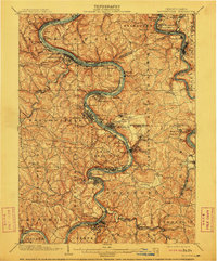
The Monongahela River carves a deep, winding path through southwestern Pennsylvania, serving as the industrial and transportation spine for numerous settlements at the turn of the century. This survey documents the dense concentration of river towns such as Monessen, Donora, and Charleroi, where the topography dictated narrow, linear development between the water and the rising hills. Further east, the Youghiogheny River cuts through the landscape, flanked by the Pittsburg & Lake Erie RR and the Baltimore and Ohio RR. The map captures the region's transition from agricultural uplands, marked by landmarks like Salem Church and Fells Church, to the heavy riverfront industry implied by features like Lock No 4 and the coal-related namesake of Black Diamond. The complex web of rail lines, including the Washington Run RR, underscores the era's reliance on steam transport to move resources from the valley's steep slopes.
Find a feature on this map
132 named features on this map. Tap any name to fly to it.
Don’t see what you’re looking for? This feature index may not catch every label — zoom into the map to look around manually.
Map Details
Editions of this 1906 Brownsville Map
4 editions found
Other maps of this area

1900 · Uniontown
USGS Topo · 1:62,500

1900 · Masontown
USGS Topo · 1:62,500

1901 · Amity
USGS Topo · 1:62,500

1901 · Waynesburg
USGS Topo · 1:62,500

1902 · Brownsville
USGS Topo · 1:62,500

1902 · Connellsville
USGS Topo · 1:62,500

1903 · Masontown
USGS Topo · 1:62,500

1904 · Amity
USGS Topo · 1:62,500

1904 · Mc Keesport
USGS Topo · 1:62,500

1904 · Waynesburg
USGS Topo · 1:62,500