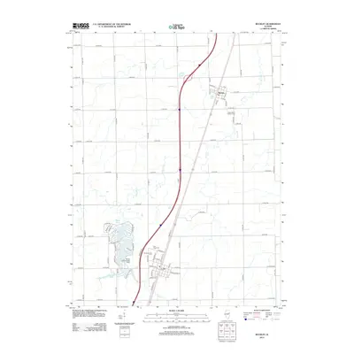
2012 Map of Buckley
USGS Topo · Published 2012About this map
Buckley stands as a central hub in this section of Iroquois County, defined by a rigid grid of agricultural roads and the winding path of Spring Cr. The landscape is predominantly rural, yet it is punctuated by significant water features like Bayles Lake, Iroquois Lake, and Widner Lake, which introduce a different character to the otherwise geometric field patterns. Local history is anchored at Saint John's Lutheran Cem near the town center and Pine Ridge Cem further south. An interesting detail is the Bayles Lake Landing Strip, suggesting the importance of private aviation for this community. The map reveals the classic Midwestern settlement pattern where small towns like Buckley are connected by a network of county roads such as Co RD-900 and Co RD-650, supporting a legacy of farming that continues into the modern era.
Find a feature on this map
73 named features on this map. Tap any name to fly to it.
Don’t see what you’re looking for? This feature index may not catch every label — zoom into the map to look around manually.
Map Details
Editions of this 2012 Buckley Map
This is the sole edition of this map. No revisions or reprints were ever made.
Other maps of this area

1924 · Paxton
USGS Topo · 1:62,500

1927 · Paxton
USGS Topo · 1:62,500

1936 · Potomac
USGS Topo · 1:62,500

1939 · Cissna Park
USGS Topo · 1:62,500

1948 · Buckley
USGS Topo · 1:62,500

1949 · Cissna Park
USGS Topo · 1:62,500

1949 · Buckley
USGS Topo · 1:62,500

1949 · Paxton
USGS Topo · 1:62,500

1953 · Danville
USGS Topo · 1:250,000

1955 · Danville
USGS Topo · 1:250,000