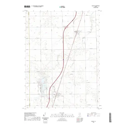
2021 Map of Buckley
USGS Topo · Published 2021About this map
Buckley and Loda serve as the primary residential hubs on this agricultural landscape in Iroquois County. The town of Buckley is organized around its northern corridor, including Main St and Railroad Ave, reflecting its historic orientation to the rail line. To the southeast, the Saint Johns Lutheran Cemetery stands as a significant local landmark.
Find a feature on this map
42 named features on this map. Tap any name to fly to it.
Don’t see what you’re looking for? This feature index may not catch every label — zoom into the map to look around manually.
Map Details
Editions of this 2021 Buckley Map
This is the sole edition of this map. No revisions or reprints were ever made.
Other maps of this area

1924 · Paxton
USGS Topo · 1:62,500

1927 · Paxton
USGS Topo · 1:62,500

1936 · Potomac
USGS Topo · 1:62,500

1939 · Cissna Park
USGS Topo · 1:62,500

1948 · Buckley
USGS Topo · 1:62,500

1949 · Cissna Park
USGS Topo · 1:62,500

1949 · Buckley
USGS Topo · 1:62,500

1949 · Paxton
USGS Topo · 1:62,500

1953 · Danville
USGS Topo · 1:250,000

1955 · Danville
USGS Topo · 1:250,000