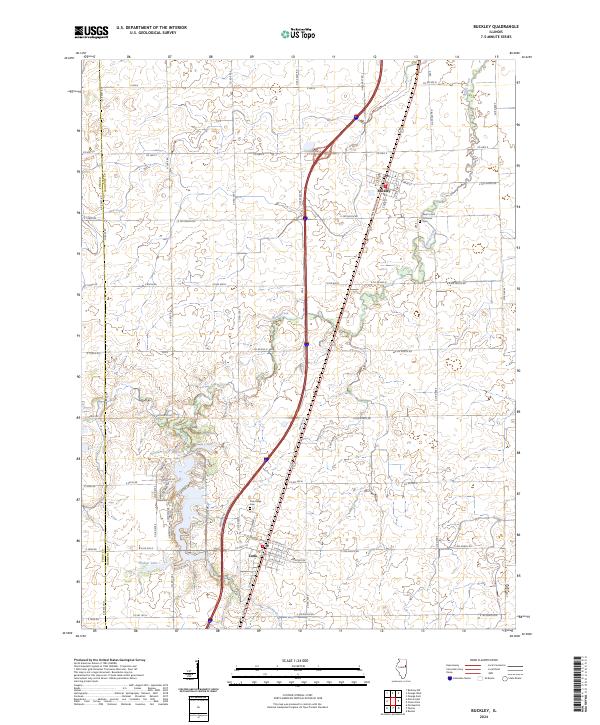
2024 Map of Buckley
USGS Topo · Published 2024About this map
Buckley and Loda serve as the primary population centers in this agricultural corridor along the border of Ford and Iroquois counties. The landscape is defined by its precise grid of rural routes, such as Co Rd 900 N and E 1300 N Rd, which partition the fertile Illinois prairie. A notable cluster of residential development and recreational water features appears near the southwestern corner, centered around Bayles Lake and Widner Lake. These water bodies, alongside the meandering Spring Creek, provide a natural contrast to the surrounding section lines.
Find a feature on this map
56 named features on this map. Tap any name to fly to it.
Don’t see what you’re looking for? This feature index may not catch every label — zoom into the map to look around manually.
Map Details
Editions of this 2024 Buckley Map
This is the sole edition of this map. No revisions or reprints were ever made.
Other maps of this area

1924 · Paxton
USGS Topo · 1:62,500

1927 · Paxton
USGS Topo · 1:62,500

1936 · Potomac
USGS Topo · 1:62,500

1939 · Cissna Park
USGS Topo · 1:62,500

1948 · Buckley
USGS Topo · 1:62,500

1949 · Cissna Park
USGS Topo · 1:62,500

1949 · Buckley
USGS Topo · 1:62,500

1949 · Paxton
USGS Topo · 1:62,500

1953 · Danville
USGS Topo · 1:250,000

1955 · Danville
USGS Topo · 1:250,000