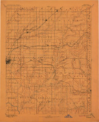
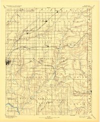
1889 Map of Burden
USGS Topo · Published 1913About this map
Winfield serves as the primary hub in this late nineteenth-century portrait of Cowley County, where several rail lines converge to shape the local economy. The Kansas City and Southwestern Railroad cuts diagonally through the northern townships, connecting settlements like Atlanta and Wilmot. To the south, the Denver Memphis and Atlantic Railroad links Winfield to Dexter, while the Southern Kansas Railroad passes through the town of Burden. This network illustrates a landscape in transition, where established river-valley settlements are being joined by new shipping points along the iron rails. The drainage patterns of Grouse Creek, Dutch Creek, and Badger Creek reveal the undulating prairie topography that defined early Kansas ranching and farming long before modern irrigation and interstate travel altered the region.
Find a feature on this map
65 named features on this map. Tap any name to fly to it.
Don’t see what you’re looking for? This feature index may not catch every label — zoom into the map to look around manually.
Map Details
Editions of this 1889 Burden Map
6 editions found
Other maps of this area

1885 · Eureka
USGS Topo · 1:125,000

1885 · Sedan
USGS Topo · 1:125,000

1888 · Eureka
USGS Topo · 1:125,000

1888 · Eldorado
USGS Topo · 1:125,000

1889 · Burden
USGS Topo · 1:125,000

1889 · Sedan
USGS Topo · 1:125,000

1889 · Wichita
USGS Topo · 1:125,000

1890 · Wellington
USGS Topo · 1:125,000

1894 · Wichita
USGS Topo · 1:125,000

1894 · Eureka
USGS Topo · 1:125,000