
1958 Map of Burlington
USGS Topo · Published 1968About this map
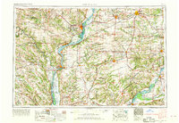
The Mississippi River serves as the dominant geographic spine of this regional survey, marking the borders of Iowa, Illinois, and Missouri during a period of significant industrial and agricultural coordination. In the Iowa sector, the Iowa Army Ammunition Plant stands out as a major federal installation near Burlington, while the network of the Chicago Burlington and Quincy RR and the Atchison Topeka and Santa Fe RR illustrates the vital mid-century rail corridors connecting the Midwest. The landscape is defined by the drainage basins of the Des Moines River, Skunk River, and Illinois River, which supported numerous riverfront settlements like Keokuk, Fort Madison, and Warsaw. This map records the integration of heavy transport with protected landscapes, such as Lacey-Keosauqua State Park and the Mark Twain National Wildlife Refuge, capturing the tri-state area before modern interstate expansions altered the rural character of the river bluffs and bottomlands.
Find a feature on this map
192 named features on this map. Tap any name to fly to it.
Don’t see what you’re looking for? This feature index may not catch every label — zoom into the map to look around manually.
Map Details
Editions of this 1958 Burlington Map
4 editions found
Other maps of this area

1903 · Kahoka
USGS Topo · 1:125,000

1903 · Palmyra
USGS Topo · 1:125,000

1903 · Edina
USGS Topo · 1:125,000

1909 · Tallula
USGS Topo · 1:62,500

1912 · Canton
USGS Topo · 1:62,500

1912 · Macomb
USGS Topo · 1:62,500

1913 · Colchester
USGS Topo · 1:62,500

1914 · Macomb
USGS Topo · 1:62,500

1915 · Avon
USGS Topo · 1:62,500

1916 · Good Hope
USGS Topo · 1:62,500